Zuleta: A Hacienda, Cows, and Drones
Last Saturday (8/19/17), I went to Zuleta with Pepe and Mariauxi.
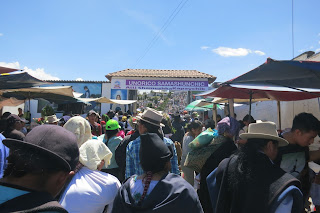
Our trip there and back was like a joke just waiting to be told. We came across
a chicken who was indeed crossing the road; a piglet on a journey; and a
full-grown pig escaping after the rainstorm (or as Mariauxi said, he was making
sure he wouldn't be dinner that night!). I don't know what exactly the joke is,
so for funsies, you let me know.
In Zuleta, we met with David Brown, Mark Willis, and Chet who were
doing an archaeological survey of the 100+ mounds on the hacienda. Mark was
using drones to be able to create a 3-D map/model of the site, and Chet was
running the magnetometer over the mounds to detect what might be under the
grass and soil of the mounds (ex: burials, structures, etc.). David, Mark, and
Chet had also worked at Cochasquí. If you look on the lefthand side of the
picture, you can see a small light figure that is Chet. The mounds are a lot
more impressive in person, but alas, this is the best I could do. Guess I'll
just have to write a fancy schmancy DSLR camera into my grant...

Mark showed us how the drone worked and said this particular drone
was new in March of this year and cost around $1000, which is actually really
cheap for a drone. The batteries, however, cost $100 each, and he has 12! Each
battery only lasts for about 20 minutes, and you can’t let it get too low, or you
risk crashing the drone. He actually has 2 of these drones, and he brought a
much larger drone that looks like an airplane. He said the plane-style drone
was more successful at Cochasquí because it does better in the wind. [Pictures:
the drone, up close and personal, in the best color; launching the drone; baby
drone flying all by itself; control panel using a smartphone. I included a
short video of the drone flying at the end of this post.]


At Zuleta, Mark flew the drone
between 90-120 meters high to capture the entire valley all the way to the
road. Depending on time and weather, he planned to go back over the mounds at
an altitude of approximately 40 meters. The higher the drone flies, the faster
it can go; when it is closer the ground, it must travel slowly to capture good
quality video/photos. He was actually having some trouble with images being
blurry and didn’t know why – one of the downsides of practically brand new
technology. He’s an expert in drones and has been working with them since
2007.

He humored us and took a
“dronie” – a “selfie” taken by a drone!

In the past, the hacienda belonged to Galo
Plaza Lasso (former president of Ecuador), and is currently owned and run by
his descendants. In the past, the townspeople would have belonged to the
hacienda. Now, the town is separate, and is famous for the hand embroidered
items done by local women. For example, the woman who embroidered Rafael
Correa’s (former president of Ecuador) shirts as well as other women who
embroider shirts, tablecloths, and other items live in the town. I, for one,
was very excited to learn about the hacienda, hang out with some cows, and geek
out over how a drone works (it's a lot more interesting in person). Proof
below.


And
for my archys or those of you who are really interested in the history of the
hacienda and these huge earthen mounds: "From around AD 700, large earthen
mounds began to be constructed in different locations throughout the northern
highlands, including at Hacienda Zuleta. The ethnic group associated with these
cultures have been called ‘the Cara’ by ethno-historians and archaeologists,
later becoming ‘Caranqui’, after the town of the same name, situated further
north near Ibarra. The people in the greater Zuleta region are still called
‘Caranquis’ today. Along with large occupation mounds, evidence of extensive
systems of raised or ridged fields called ‘camellones’ have also been found, an
intensive form of horticultural practice which would have supported the
year-round production of crops such as maize and potatoes and sustained high
regional populations. Excavations within the Zuleta ramp mound site have also
found these field systems buried under the modern pasture." (http://zuleta.com/history-of-hacienda-zuleta-in-ecuador/)


Comments
Post a Comment