San Francisco de Chorlavicite
On Sunday, we went to see an historic church because Pepe is working on a map with various historical and archaeological sites (houses, buildings, etc.). For all of my archys, it was a legit visit; I helped take the GPS coordinates so it can be properly marked on the map.

The church has obviously been is disuse for a long time, but the setting was stunning. The view into the valley and of the surrounding valleys was absolutely breathtaking.


While at the site, a parade of cows, dogs, and people walked past to get to their field. I know they were on a mission, but to see them all in a line like that was rather comical.


Right behind the old church is a huge meat processing plant that isn't open yet, and behind that you can see the Andes. The two most famous mountains in this region are Taita Imbabura (Father Imbabura; ~15,000ft high) and Mama Cotacachi (~16,000ft high), the tops of which are normally hidden by clouds and sometimes covered in snow. They are each volcanoes that run in opposite sides of the cordileras (mountain chains). Folklore describes Taita Imbabura and Mama Cotacachi as a couple, and there are many stories about their relationship and the resulting meteorological events.


Cristina makes beautiful cards/artwork out of flowers, leaves, and plants, so I helped her collect and press flowers so she can use them later.

This was my "welcome back to Ecuador" card. Such talent!

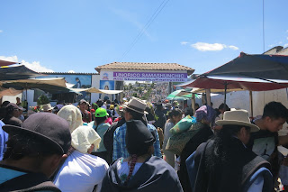
On our way home, we tried to drive along this pre-Hispanic (possibly Inca) roadway, but the road was blocked off for a motocross race going through the middle of the town because, you know, that's normal...


Comments
Post a Comment